
Kingston Student Inclusion Parkland Study.
A study for the City of Kingston on how post-secondary students and campus green space change the City's parkland service level.
- client
- City of Kingston
- location
- Kingston, Ontario
- year
- 2022
- status
- completed
- thinc's role
- student population calculation, GIS mapping and analysis of parkland service levels
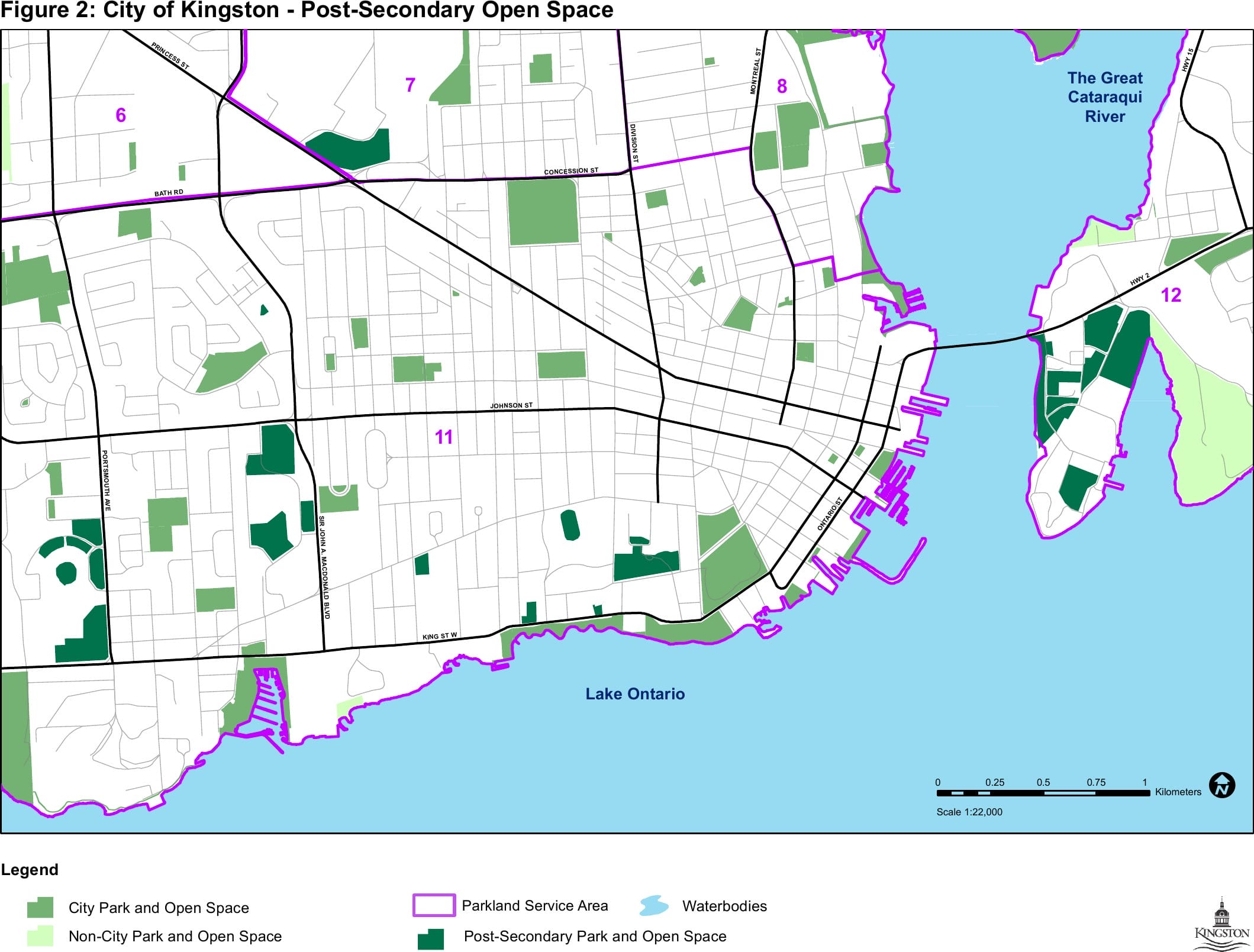
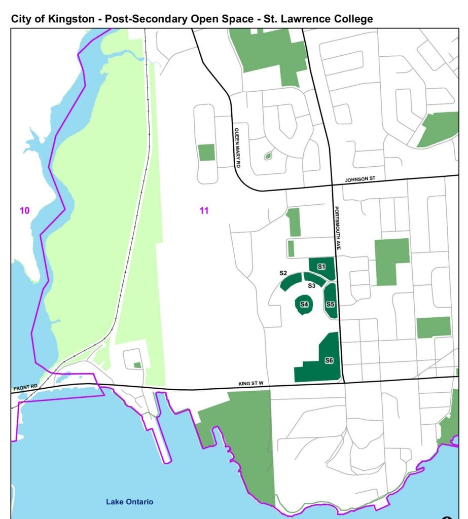
thinc design worked with City of Kingston staff to study how the post-secondary student population and post-secondary open space affect the City's Parkland Service Level, as described in the 2021 Parks and Recreation Master Plan Update. The question was considered across the whole city, with special attention to Kingston's core, which holds most of the city's students and campus open space.
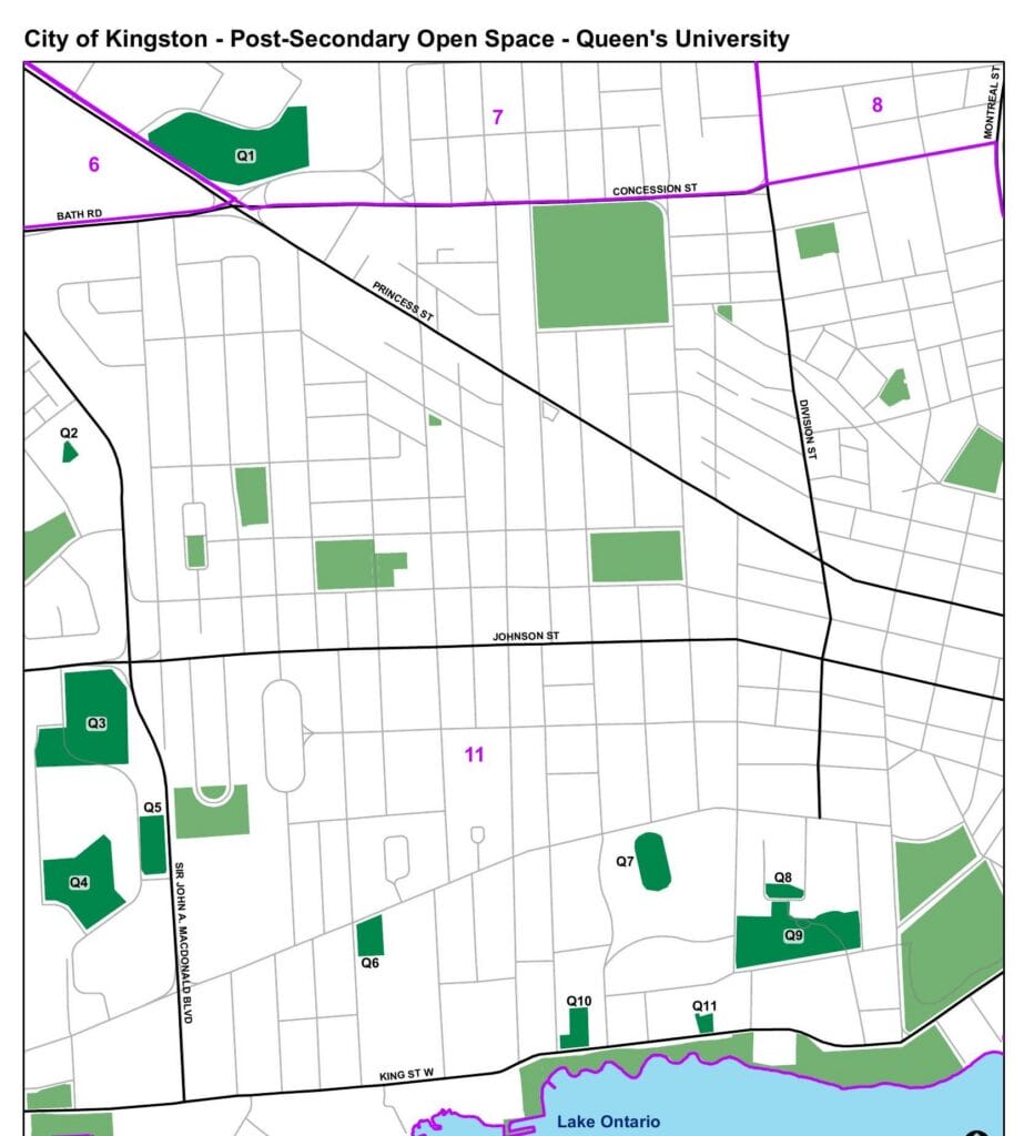
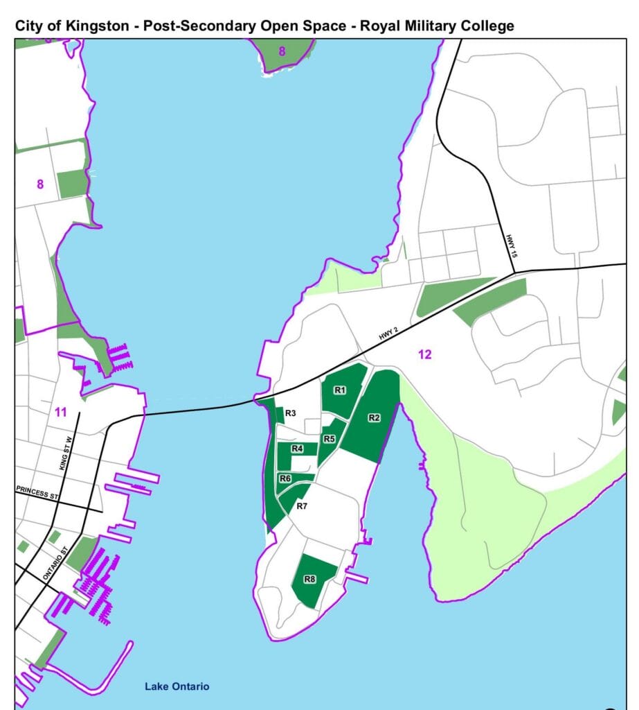
The work included estimating the number of post-secondary students living in Kingston, about 28,260 in 2021, and mapping the publicly accessible green space on the Queen's University, Royal Military College and St. Lawrence College campuses. Twenty-five campus green spaces, about 43.7 hectares, had not been counted in the master plan's parkland calculations. More than half of that area sits in Park Service Area 11.
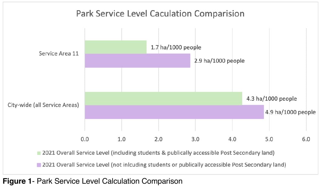
With students and campus green space included, the city-wide service level is 4.3 hectares per 1000 people, 0.6 hectares less than the original 4.9. In Service Area 11 it falls from 2.9 to 1.7.
The study recommended that the City treat post-secondary open space as part of a broader parkland resource, and work with the institutions on shared opportunities where possible.
more parks and recreation plans
 kingston belle park master plan
City of Kingston · master plan
 quinte west parks and recreation master plan
 south frontenac recreation, parks and leisure master plan